Block and Location Plans
BLOCK, SITE SKETCHES & LOCATION SCHEMES
Every Planning Application necessitates SITE LAYOUT SKETCHES, commonly referred to as SITE PLANS, and a SITE LOCATION SCHEME.
ALL OS BASE LAND REGISTRY MAPPING IS PROTECTED BY OUR COPYRIGHT & OUR ADMIN TEAM PROVIDES THEM WITH A 12-YEAR LICENCE USE TO MEET ALL PLANNING VETTING REQUIREMENTS.
Can I use Other Third Party Maps when providing the Council with BLOCK & LOCATION SCHEMES?
The responsibility for furnishing accurate materials for Planning applications lies with the Administration team engaged for the application submission. To ensure a successful planning application, specific criteria must be met for each map requested by the council. Failure to utilize the correct materials may lead to delays in the validation and vetting process and could also result in crown copyright infringement if no licence numbers are secured. To deter such mistakes, some Borough councils are now imposing an administrative charge of £65 for invalid applications. Therefore, it is vital to furnish precise and current information to prevent unnecessary delays or penalties. Instances have arisen where clients have forwarded alternative land registry plans from different sources to our Admin team, attempting to cut costs. Unfortunately, such plans cannot be accepted for planning applications by the appointed personnel handling the submission. (this is elucidated in email correspondence at the submission stage)
The Council’s Planning Department’s vetting team requires two maps for each application submitted, namely:
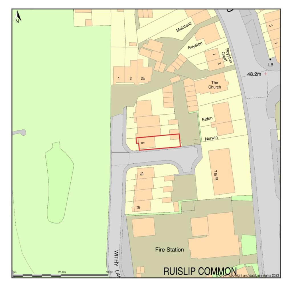
A Site Location Scheme, a map scaled at 1:1250 or 1:2500 depicting the property’s location relative to the surrounding area, preferably presented on A4 or A3 drawings.
A Block Scheme (Site Layout) must also be provided, a map scaled at 1:500 or 1:200.
The Site Location Scheme and Block Schemes (illustrated below) are procured from a Licensed online Mapping organisation, granting 12-Month Licences with each OS purchase. The Schemes are then modified in Autocad to align with the status of the specific development, ensuring compliance with the Council’s Planning vetting requirements, complete with Licence numbers displayed.


